Inhaltsverzeichnis
Friedrich-Wilhelm-Jungius-Cup for gas balloons | Scoring Aera | Submit Flight Data | Results
Scoring area and scoring
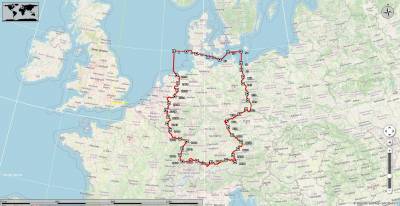
Scoring area
The outer boundary of the scoring area is defined by coordinates (WGS84), which are connected by a line.
Scoring
Example
1. Track file
2. Conversion for Google Earth
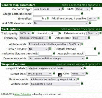
With https://www.gpsvisualizer.com/map_input?form=googleearth
and the following settings:
Important: Altitude mode: Extruded (connected to ground by a „wall“)
3. Load into Google Earth
Load the track file 2010-08-21_dostz_lindecup_air.kmz and the file of the competion area jungiuscup_wertungsgebiet_deutschland.kmz in Google Earth.
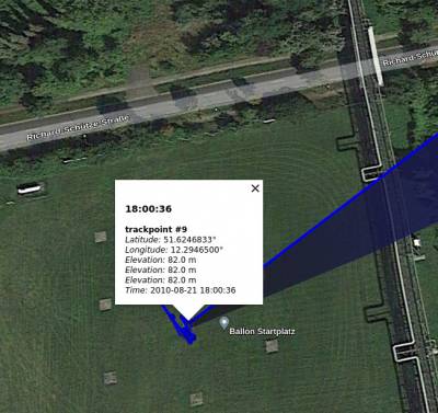
4. Search for track point 1
In the example, track point 1 is identical to the starting point.
Date: 2010-08-21 UTC: 18:00:36
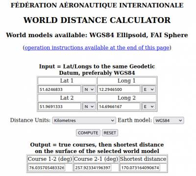
Coordinates: 51.6246833° N 12.2946500° E
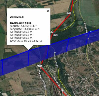
5. Search for track point 2
Track point 2 is the last track point before the boundary of the scoring area. As the points are connected to the ground with a line, it is easy to see which is the last point.
Date: 2020-08-21 UTC: 23:32:18
Coordinates: 51.9691333° N 14.6966167° E
6. Enter in FAI Distance Calculator
Download the fai_distance_calculator_v1.0_1.zip and unzip it. Then open the HTML file in your browser.
Attention: Set Longitude to E.
After entering the coordinates, press COMPUTE and the result appears at the bottom right.
Result
Distance within the scoring area 170.07 km
